Last updated July 20, 2018 at 8:34 pm
A gigantic crater in the Australian outback captured by the ESA, but described by the local Indigenous people.
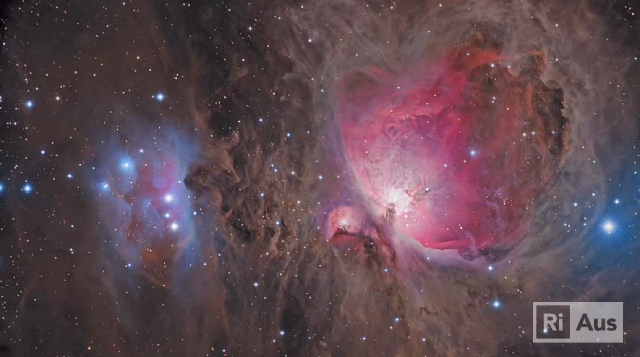
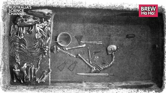
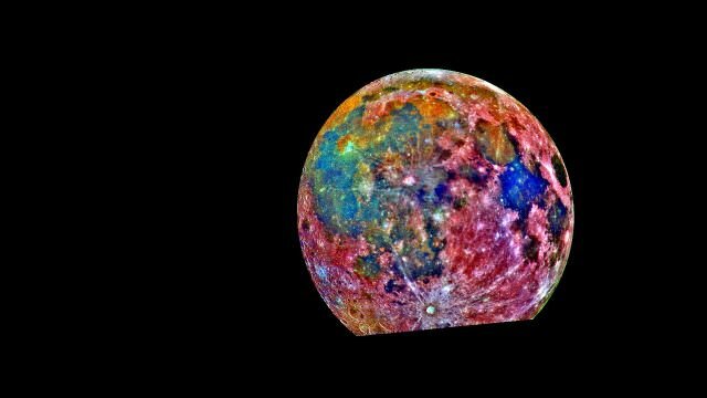
Gosses Bluff/Tnorala is captured by the ESA’s Copernicus Sentinal-2A satellite, and shown in this false-colour image. Tnorala is in the centre left of frame, with the faint ring of the original 22km-wide crater still seen circling it. Click to enlarge. Credit: ESA
The European Space Agency’s Copernicus Sentinel-2A satellite captured this stunning image of the Gosses Bluff/Tnorala crater in the Northern Territory in February 2016.
The crater, in the left centre of the image, is situated around 200km west of Alice Springs. It is thought to have been formed 142 million years ago by the impact of a comet measuring up to 1km across, slamming into Earth.
The rim of the original 22km-wide impact crater has eroded away, leaving a faint ring that can be traced around the area. However, a 4km-wide circle of mountains remains, thought to be the remnants of the crater’s centre uplift.
The story of Tnorala’s creation
The site is known as Tnorala to the Western Arrernte people, and is a sacred place.
They also attribute its origins to a cosmic impact. In the Dreamtime, a group of women were dancing as stars in the Milky Way.
One of the women was carrying a baby, so placed the child in a wooden basket called a coolamon.
As the women danced the basket slipped and fell, plunging towards Earth. The baby struck the Earth with the coolamon falling on top, the force of which thrust the rocks upward and forming the circular mountain range.
The baby’s parents – the evening and morning stars – continue to search for their baby to this day, and form important celestial features for the local Indigenous people.
The image
The false-colour image from Sentinal-2A shows an extremely dry area with some vegetation visible in reddish colours along the rivers and lakes.
The intense colours of the image represent the mineral composition of the land, revealed to the satellite by the lack of vegetation.
The West MacDonnell Ranges are seen in the upper section of the image, and part of the Petermann Ranges are shown in the lower portion.
We respectfully acknowledge the Arrernte people as the caretakers of the Tnorala story. Read more about the Tnorala story at Australian Indigenous Astronomy.