Last updated January 8, 2018 at 12:14 pm
NASA’s Operation IceBridge has been flying over Antarctica to measure changes in land and sea ice at the bottom of the world for the past nine years.
The airborne survey is designed to give unprecedented 3D views of Earth’s polar ice, ice sheets, ice shelves and sea ice in the Arctic and Antarctic.
Data collected will help scientists bridge the gap in polar observations between NASA’s Ice, Cloud and Land Elevation Satellite (ICESat), which operated from 2003 to 2010, and ICESat-2, planned for 2018.
IceBridge maps Arctic and Antarctic areas once a year, in March-May over Greenland and in October-November over Antarctica.

Credit: NASA/Nathan Kurtz
The above was taken on 31 October 2017, on the flight over the Larsen C ice shelf.
Soon after beginning the 2017 campaign, the mission flew over one of the most obvious signs of change in 2017: a giant iceberg the size of the US state of Delaware that recently calved off of Larsen C.
The iceberg is more than 200 metres thick and has a total volume twice the size of Lake Erie.
Even so, it won’t contribute any more to sea level rise, as it’s been floating as part of an ice shelf for a long time. Scientists are still researching whether the removal off all that ice will have any effect on the flow rates of glaciers upstream from the Larsen C.

Credit: NASA/Chris Larsen
An iceberg floats in Antarctica’s McMurdo Sound in the image above taken on 29 November during a flight to Victoria Land.
The part of the iceberg below water appears intensely blue primarily due to blue light from the water in the Sound. The undersides of some icebergs can be eroded away, exposing older, denser, and incredibly blue ice.
Erosion can change an iceberg’s shape and cause it to flip, bringing the sculpted blue ice above the water’s surface.

Credit: NASA/John Sonntag
A fjord in southern Greenland, as seen during Operation IceBridge’s last flight of the 2017 Arctic campaign, on 12 May 2017.
This final full science flight, ICESat-2 South, was designed along the ground tracks of NASA’s upcoming Ice, Cloud, and land Elevation Satellite-2 (ICESat-2), to fill in a gap in altimetry coverage of central southern Greenland.
Credit: NASA/Joe MacGregor
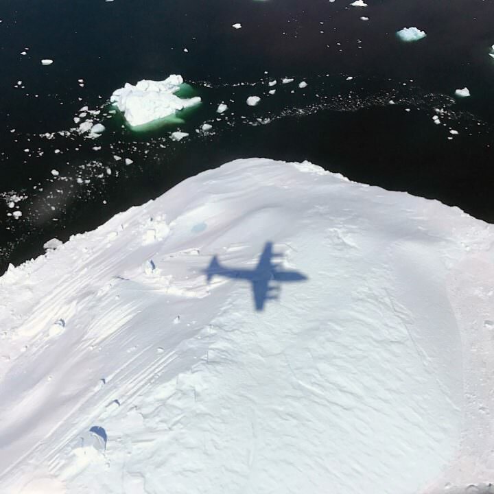
The shadow of NASA’s P-3 aircraft passes over an iceberg on a 8 May 2017 flight during the Arctic Spring 2017 surveys over Greenland, called Southeast Glaciers 01.

Credit: NASA/John Sonntag
An oblique view of a massive rift in the Antarctic Peninsula’s Larsen C ice shelf photographed on 10 November. The Larsen C fracture is about 45 kilometres long, more than 100 metres wide and about 540 metres deep. The crack completely cuts through the ice shelf but it does not go all the way across it.
Credit: NASA/Jeremy Harbeck
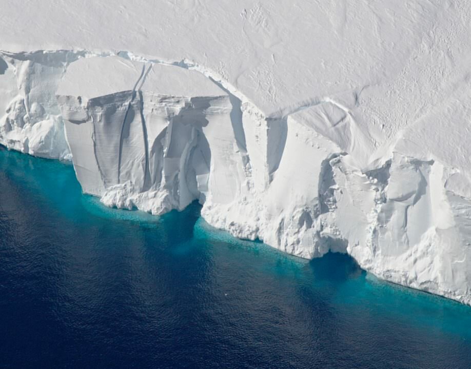
The image above shows a views of the Getz Ice Shelf in western Antarctica south of South America on 5 November.


